© Roman Eisele / Wikimedia Commons / CC BY-SA 4.0
.

On this page, you will find a collection of links to scientific publications that are relevant to this project or that can contribute to a deeper exemplary understanding of the processes and circumstances that may be related to the Reinterpretation of Germania Magna presented here. These publications span different research areas.

The collection includes:

  • Primary literature: Scientific publications presenting the results of new research.
  • Secondary literature: Scientific publications summarizing, analyzing, or interpreting primary literature.
  • Comparative literature: Publications that exemplify similar processes and circumstances in other contexts.
  • Additional resources: Links to websites, databases, and other resources that may be relevant to the reinterpretation

The following publications are intended to help answer specific questions exemplarily, which may be related to the necessary processes and events required for extensive landscape transformation. These include considerations of tectonic fracture events and rift systems, with corresponding effects on maritime landslide events and the formation of new sedimentation basins.


Germania magna – A new look at an old map: Rectifying Ptolemy’s geographical data for ancient places between the Rhine and the Vistula.


Nüsse, Hans-Jörg & Marx, Christian & Lelgemann, Dieter. (2011). Germania magna - A new look at an old map: Rectifying Ptolemy's geographical data for ancient places between the Rhine and the Vistula. Germania. 89. 115-155. https://doi.org/10.11588/ger.2011.96480

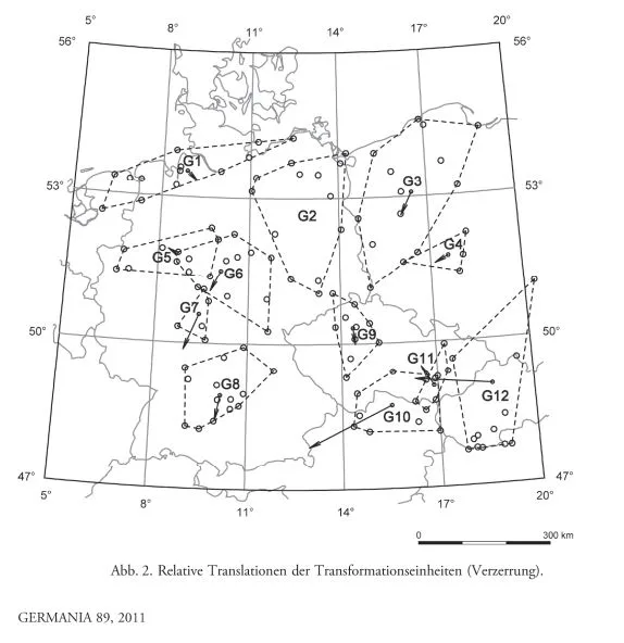
DOI https://doi.org/10.11588/ger.2011.96480 Abstract This paper deals with the geographical indications for Germania magna in the Geographike Hyphegisis (ca. AD 150) of Claudius Ptolemaeus. Previous attempts at the identification of Ptolemaic locations were neither comprehensive nor based on a qualified analysis of the ancient data. By means of the geodetic-statistical analytic method presented here, an appropriate study of the Ptolemaic coordinates in conjunction with the identification of almost all Ptolemaic landmarks in Germania magna could be performed for the first time. The results of the investigation are presented and examined for their archaeological significance; the archaeological-historical information contained in the Germania-map is extracted. Nüsse, Hans-Jörg & Marx, Christian & Lelgemann, Dieter. (2011). Germania magna – A new look at an old map: Rectifying Ptolemy’s geographical data for ancient places between the Rhine and the Vistula. Germania. 89. 115-155. https://doi.org/10.11588/ger.2011.96480