The Chiemgau Meteorite Impact Strewn Field and the Digital Terrain Model: “Earthquake” Liquefaction from Above and from Below
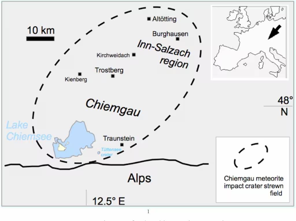
DOI http://dx.doi.org/10.13140/RG.2.2.11274.79041 Abstract The Chiemgau strewn field discovered and established in the early new millennium(Schryvers and Raeymaekers, 2004; Schüssler et al., 2005; Rösler et al. 2005, Rappenglück,M. et al., 2005, Hoffmann et al., 2005, 2006; Yang et al 2008), extensively investigated in thefollowing decade until today (Ernstson et al. 2010, 2011, 2012, 2013, 2014, 2017, 2020, 2023,2024, Hiltl et al. 2011, Isaenko et al. 2012, Rappenglück, B. et al. 2010, 2020 a, b, c, 2021,Rappenglück M.A, et al. 2013, 2014, Bauer et al. 2013, 2019, 2020, Shumilova et al. 2018,Ernstson and Poßekel 2017, 2020 a, b, 2024, Ernstson and Shumilova 2020, Poßekel andErnstson 2019, 2020), and dated to 900-600 BC in the Bronze Age/Iron Age (Rappenglück, B.et al. 2023) comprises far more than 100 mostly rimmed craters scattered in a region of about60 km length and ca. 30 km width in the very South-East of Germany. The crater diametersrange between … WeiterlesenThe Chiemgau Meteorite Impact Strewn Field and the Digital Terrain Model: “Earthquake” Liquefaction from Above and from Below